BRT Central Section
Arkansas Section Trails
On-line Recon Map
Section Driving Directions and Trail Information
Each section trail is shown in red and each shows the connection with an adjoining loop trail in turquoise. Section trails are typically two or three day hikes but some may be 5 day hikes or more.
Weather Forecast and Current Radar
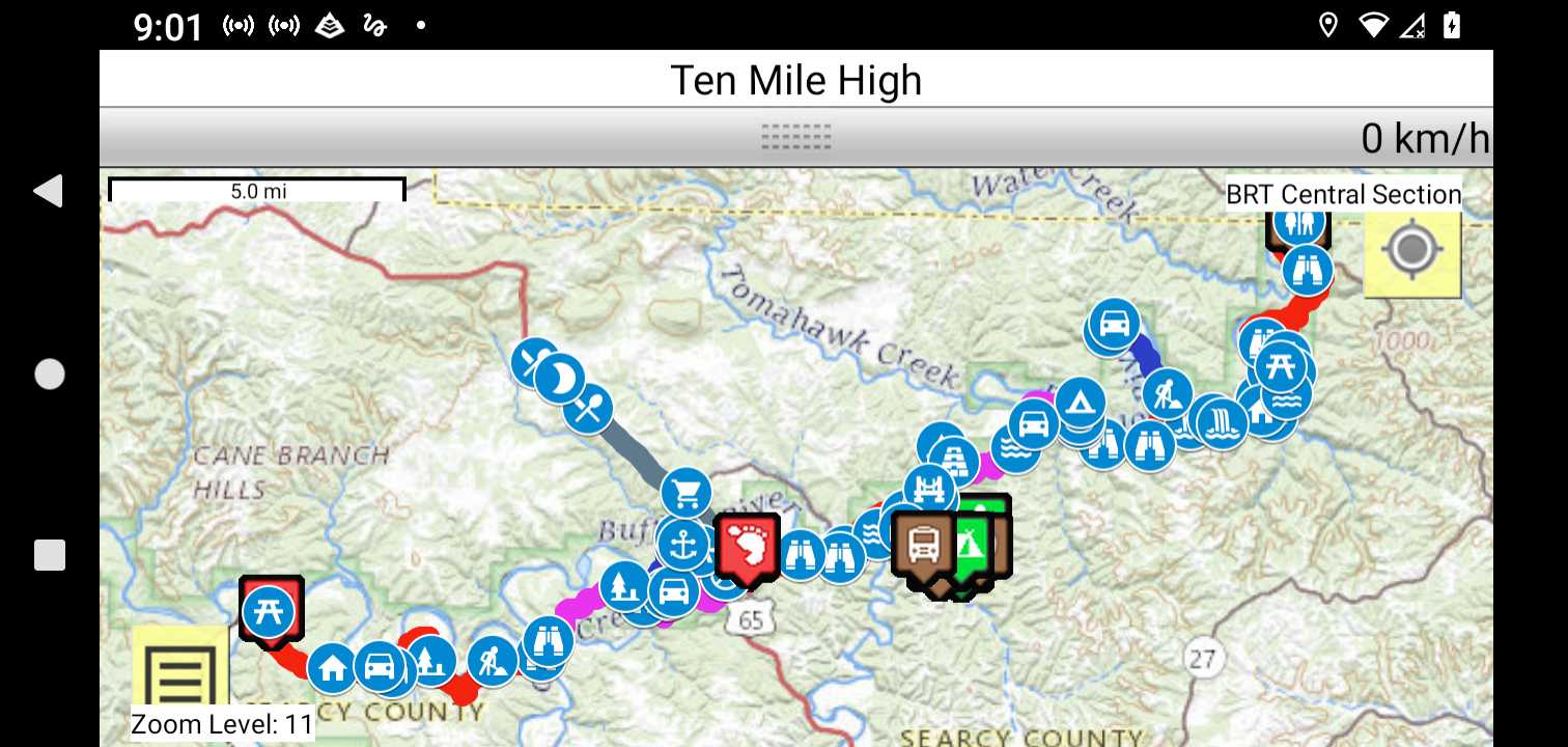
Trail Map as it Appears in the App
Facebook Search Links
Buffalo River Trails search results in Midwest Central States Hiking FB group
Buffalo Rivr Trails search results in FB groups
Buffalo Rivr Trails search results in Ozark Trail Section Hikers And Backpackers FB group
You must register with FB and join the FB groups to post!
Genral Info
Buffalo River trails - Middle and Lower River Area

Topographic Map Links
Do NOT hit the trail without paper maps and a compass. This ain't Disneyland!
Purchase Buffalo National River Map Pack Bundle
If you prefer maps that you can use on a mobile device or print yourself, download these PDF's:
Buffalo River trails - Middle and Lower River Area

Print the topo map and carry with you while on trail! Also carry a compass!
The Tim Ernst trail guides offer much valuable information Tim Ernst Photography