The U.S. Interior Highlands Trails
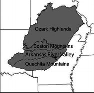
The U.S. Interior Highlands is a mountainous region in the Central United States spanning northern and western Arkansas, southern Missouri, eastern Oklahoma, and extreme southeastern Kansas. The name is designated by the United States Geological Survey to refer to the combined subregions of the Ouachita Mountains south of the Arkansas River and the Ozark Plateaus north of the Arkansas. The U.S. Interior Highlands is one of few mountainous regions between the Appalachians and Rockies.
Ten Mile High Android App Features
The Ten Mile High GPS data set contains all the routes and waypoints seen in this map to include:
- Nearby cities and resupply, lodging, Post offices, services, cafes, clinics, and etc.
- Water sources, spring, creeks, waterfalls
- Established known primitive campsites and shelters
- Shuttle services
- Trail heads, trail intersections, national forest boundaries
- Parking at trailheads with driving directions
- Points of interest
- Adjoining trail loops
- Black bear sightings and population density map
- Developed campgrounds
- River landings with driving directions
- Outfitters
- Driving directions to bailout points and for trail maintenance access
- Known river obstructions like low water bridges
The Ten Mile High Routes App has documentation you need to prepare for your hike to include:
- Forest service trail and recreation area descriptions
- State Park descriptions
- PDF topo maps for download
- Water resistant topo maps for purchase
- County Sheriff contact
- FCC 4G LTE coverage map
- Leave No Trace Principals
- Links to social media having relevant trail information
- Light Pollution Map
- Trail Maintenance Associations
- Loop, Sections, and Paddlers' Information
- Recommended gear lists
- Roadwalks, with river canoe/float alternate routes
- Description of Great circle and thru hike routes
Ten Mile High App GPS Routes
The Ten Mile High App
You can purchase any section of the Interior Highlands trail system seperatly on the page of this website specific to that section.
Route Updates
The GPS tracks have been confirmed from various sources. However, the trail system is ever evolving due to landslides, floods, tree blowdowns, and\or rerouted by the trail maintainers. Also, the data sources may be outdated including those from the OTA. The route will be updated on your smart phone if there are any changes or new information.
You should synchronize with the Ten Mile High cloud prior to departure and when you have a solid data connection while on trail to see the updated routes. Purchase the routes from the store.
GPS Accuracy
GPS-enabled smartphones are typically accurate to within a 4.9 m (16 ft.) radius under open sky (GPS Accuracy). However, their accuracy worsens near buildings, bridges, and trees.
Many things can degrade GPS positioning accuracy. Common causes include:
- Satellite signal blockage due to buildings, bridges, trees, canyon walls, and etc.
- Indoor or underground use
- Signals reflected off buildings or walls ("multipath")
Mileage Computation
Using GPS to calculate distance traveled is problematic. The mileage calculation is the sum of straight line distances between points and thus if your GPS sampling interval is infrequent then the distance you traveled does not account for the twists and turns of the path you followed and the degraded GPS accuracy also affects this calculation.
Getting Back on Track
If you should lose the trail go back to your last known certain point on the trail then bushwhack in ever widening circles until you find the trail continuation. Often times the trail becomes so littered with leaves that it impossible to see but you may be able to feel the trail edge with you foot. Look for cut logs, horse apples, and hoof prints to keep on track. You should also consider the topographic terrain elevations to determine if you are downslope or upslope of the trail and travel accordingly. Typically the trails take the path of least resistance with little pointless up/downs (PUDs) so follow the constant elevation contours. Learn how to read a topographic map.
Trail Condition Reports by Users
The Ten Mile High Routes App has an interface to a social media platform where users can post trail conditions, additional primitive campsites, water sources, and bear/feral hog activity. The App also supports the upload of track and waypoint revisions. These data submissions are reviewed and may be added to or modify the data set. Trail condition alerts will be posted by staff when they become available from the various trail maintenance associations.
Internet Connection Alert
The App monitors for internet connections while your hiking. Mind your battery usage. Carry a 20,000 mAh backup battery for your electronics. Watch what Daisy say about Electronics
Driving Directions as it Appears in the App
To create driving directions: Click on car or canoe icon and a panel will slide out. click on directions icon. "Google Map" will open on you PC, "Google Go" will open on your smart phone. The square icons are FYI only.
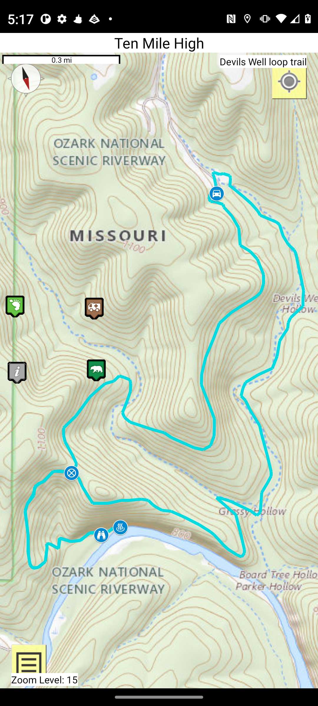
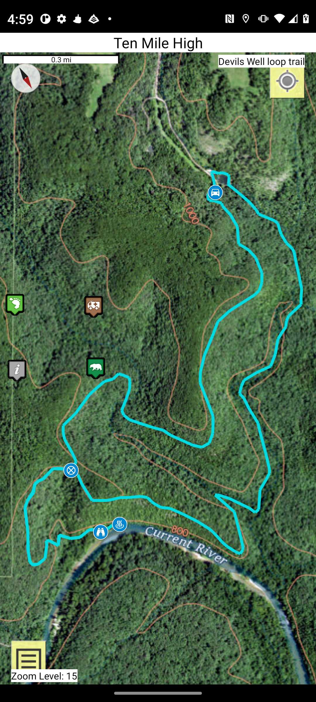
Trail Map as it Appears in the App
Click on waypoint for more information. Click on the track to view the topographic map.
Ten Mile High App Topographic Maps
Offline Viewing
Topographic maps as single sheets of each loop, section, and river are available on the app for offline viewing. Support the OT, OHT, and ONRT and purchase their map and booklet products. Print the topo map and carry with you while on trail! Also carry a compass and know how to use it and the topo.
Trail map and Compass Training
Trail Segments
The trail sections are split into segments which correspond to the each page of the PDF file obtained from the applicable source (OTA, OHTA, FOOT, and etc) so that only the applicable topo is viewed at your current location on the trail. Touch the trail segment to view information and the Topo.
Ten Mile High App Base Layer Maps
You can select 1 of 2 base layers to display the routes off-line as seen in examples below.
USGS Topo Map as it Appears in the App
USGS Satellite Map as it Appears in the App
Ten Mile High App Maps Source Data
We have scoured the web for every piece of relevant information and annotated the waypoints and tracks.
The links to this information can be found in the Section, Paddlers, and Loop Information waypoints.
Descriptive excerpts from a few of these links can be found throughout for reading off-line.
Government Entities
- Mark Twain National Forest
- Ouachita Nationall Forest
- Ozark-St. Francis National Forest
- US Geological Survey - Water levels
- National Park Service - National Scenic Riverways
- National Park Service - Buffalo National River
- Missouri State Parks
- Missouri Department of Conservation
- US Corps of Engineers - Wappapello Lake
- US Corps of Engineers - Norfork Lake
- US Corps of Engineers - Clearwater Lake
- US Corps of Engineers - Missouri River
- US Corps of Engineers - Arkansas River
- Arkansas State Parks
- Arkansas - The Natural State
Websites
- About Open Street map
- Open Street Map
- Gaia GPS
- All Trails
- Hiking Project
- Google maps
- Ouachita Maps
- Compulsive Hiker
- Trail Forks
- Southwest Paddler
- Pavement Ends
- Tim Ernst Potography and Publishing
- Arklahoma Hiker
- National Geographic Maps
- Wilderness Rider
- Lost in the Ozarks
- Peak Bagger
- Way Marking
- L-A-D Foundation
- Missouri Canoe & Floaters Association
- Missouri River Water Trail
- MR340 - THE WORLD'S LONGEST NON-STOP RIVER RACE
- MIDWEST PADDLE RACING
- Canoeman.com
Trail Associations
- Ozark trail Association
- Friends of the Ouachita
- Ozark Highlands Trail Association
- Poplar Bluff Trails Association
- Missouri River Water Trail
- Missouri Canoe and Floaters Association
- Various Outfitters
- Personal Experience
Pay It Forward
Social Sites
Share Your experiences on the following social media sites so that others may benefit.
- Midwest Central States Hiking
- Ozark Trail Section Hikers And Backpackers
- Friends of the Ouachita Trail
- Homemade Wanderlust Backpacking Forum
- Ozark Trail Association Volunteers
- Ozarks Float Trips
- Arkansas Hiking
- Missouri Hiking and Backpacking
- Ozark Highlands Trail OHT
- Current River, Jacks Fork & Eleven Point River (Missouri Scenic Rivers)
- Corporals Corner
Youtube Channels
Missions
Trails, once built, will not survive without maintenance. Mother Nature is constantly trying to reclaim the trail corridor. Trees fall; saplings, shrubs, grasses, vines and briars grow, etc.Without a volunteer workforce, the trails would soon become unusable.