OT Wappapello Section
Missouri East Section Trails
Section Driving Directions and Trail Information
Each section trail is shown in red and each shows the connection with an adjoining loop trail in turquoise. Section trails are typically two or three day hikes but some may be 5 day hikes or more.
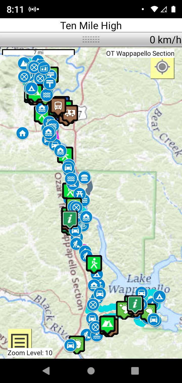
Trail Map as it Appears in the App
Weather Forecast and Current Radar
MISSOURI CURRENT RADAR (INTELLICAST)
Facebook Search Links
Wappapello section search results in Ozark Trail Section Hikers And Backpackers FB group
You must register with FB and join the FB groups!
Topographic Map Links
Here is link to OT Wappapello section topo.

Here is link to purchase OT Wappapello Section map
Support the OT and purchase their map and booklet products.
Print the topo map and carry with you while on trail! Also carry a compass!
Forest service roads are shown on the USDA Wappapello Section of the Ozark Trail
Roadwalk
This is a 6.5 mile road walk between the the Wappapello Section and the Victory Section.
There are toilets at the Hendrickson landing. You can cool down and take dip in the Black River.