Wappapello State Park Loops
OT Wappapello Section - Missouri East Loop Trails
On-line Recon Map
Loop Driving Directions and Trail Information
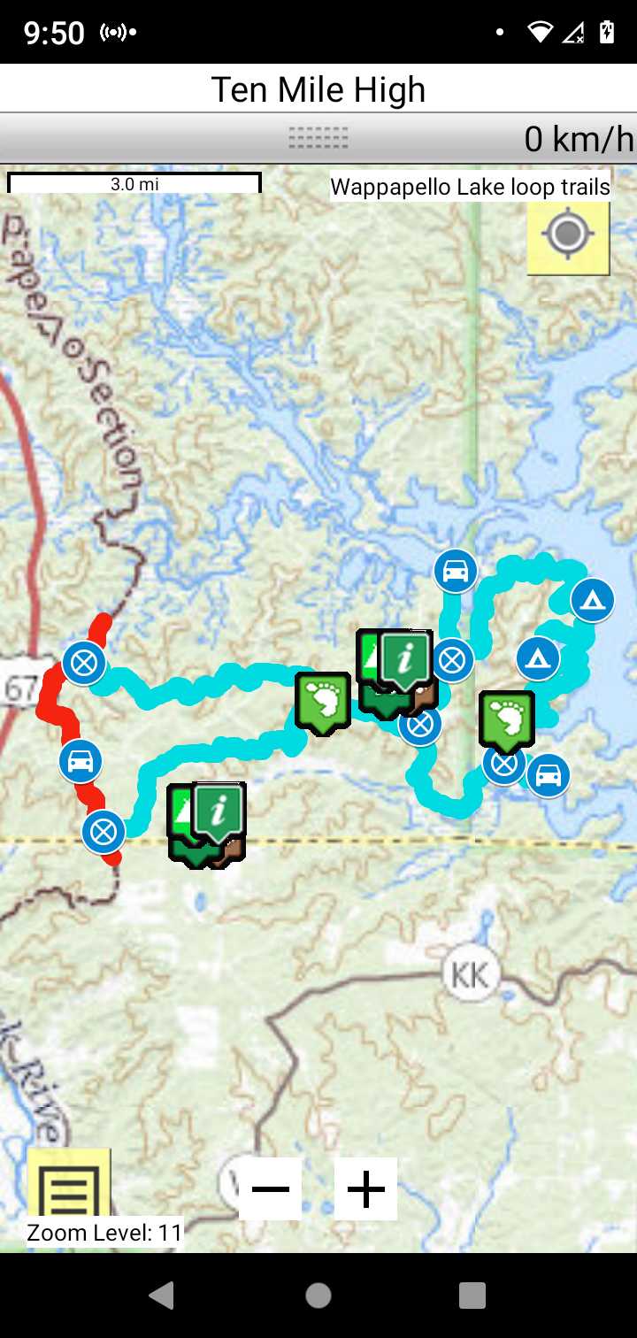
Each loop trails is shown in turquois and each shows the connection with the Secvtion Trail in red. Loop trails are typically one or two day hikes. Some loop trails are comprised of multiple intersecting trails. You pick the loop you want to hike.
Trail Map as it Appears in the App
Weather Forecast and Current Radar
MISSOURI CURRENT RADAR (INTELLICAST)
Facebook Search Links
Wappapello search results in Ozark Trail Section Hikers And Backpackers FB group
You must register with FB and join the FB groups to post!
Topographic Map Links
Here is link to OT Wappapello Section topo.

Here is link to purchase OT Wappapello Section map
Support the OT and purchase their map and booklet products.
Print the topo map and carry with you while on trail! Also carry a compass!
LAKE WAPPAPELLO STATE PARK Trails
University Forest Conservation Area
University Forest Conservation Area Brochure
The Poplar Bluff Trails Coalition maintains the Wappapello Lake State Park trails. Volunteer now!